


The City of Vancouver, Washington’s 5 Core Strategies for Building a Condition Assessment Program
The City of Vancouver, incorporated in 1857, borders the Columbia River in southwest Washington. Vancouver’s first sanitary sewers were installed in the 1890s. The City’s sewer utility now reaches into adjacent urban areas outside the its boundaries and serves more than 165,000 customers. The City built its in-house condition assessment and asset management program over the last 35 years to sustainably manage all sewer system assets; some well beyond their expected life. This article presents the five core strategies used to successfully build this program.
The City of Vancouver proactively manages 785 miles of sewer infrastructure, working year-round using an in-house Closed-Circuit TV (CCTV) sewer basin inspection and condition assessment program. This program was built from the ground up, beginning in the late 1980s. All basins are inspected and conditions rated on an eight- to 10-year cycle. GIS system models are used to analyze records and identify highest priority segments for rehabilitation and repair. Key strategies for Vancouver’s program success are discussed below.
Leadership & Staff – Trust, Teamwork and Program Commitment
Beginning in the late 1970s, Vancouver’s sewer program managers successfully began work to correct long-standing capacity shortfalls in our collections and wastewater treatment plant (WWTP) system and reduce public health concerns. Over time, these issues have been addressed, thanks to an unwavering commitment to meeting the community’s service needs, protecting the environment, and building public trust and confidence. As a result, the Vancouver Public Works Sewer Utility has enjoyed steady leadership and support for more than 35 years, providing the resources and direction to initiate surveys and inventories, and build new system maps and inspection programs.
While the wastewater plants were being updated and repaired, sewer staff continued to depend on 50 scale paper maps to support engineering and operations work. Starting in the late 1980s, the City began coordinating with Clark County for topographic flights to obtain aerial photos from across the region, resulting in its first set of digital maps in AutoCAD. The City then used this information to develop its first General Sewer Plan (GSP) in 1991. Through those efforts, the City was able to identify data gaps and recognize what information was still needed for system maintenance and long-term planning.
After the 1991 GSP, the City continued mapping its utility projects in AutoCAD, although nothing was yet tied to a database. Although it did not yet have a GIS program or any staff working with Geographic Information Systems (GIS) software, city officials understood the need to shift toward a database concept. Engineering departments continued developing digital water and sewer maps without ties to an asset database for many years. With strong leadership and council support, a GIS team was eventually created to grow the mapping and analysis capabilities.
Asset management leadership across departments was also essential to the Operations (OPS) program as officials implemented Computerized Maintenance Management System (CMMS) software. The existing paper maps were used to manually scale off lengths and create segment data for work orders. Several alternatives for asset ID numbers were evaluated before officials found an approach that was simple enough to work for the various teams utilizing the maps and software.
Teamwork and commitment are core values for the City’s utility operations programs. Members of the sewer operations crew have always taken strong ownership and responsibility for their work to assure the care and maintenance of the sewer system. These staff took the initiative in the early 1990s to purchase the City’s first CCTV van, initially used for trouble calls, checking for blockages or leaks and inflow and infiltration. Although early inspection efforts were under way before links were created between the database and maps, these initial inspections were recorded, viewed, and evaluated for needed system repairs or rehabilitation.
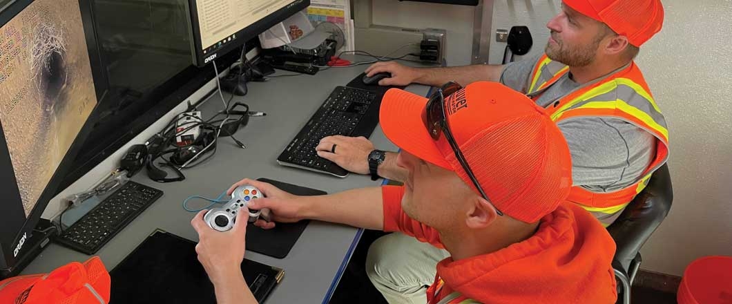
Operations staff also worked independently to outfit vans with CCTV workstations, manage the video records, and track inspection program accomplishments. Over the years, they have implemented and transitioned through three sets of CCTV inspection systems, updating as needed to remain current. After the City became certified with National Association of Sewer Service Companies (NASSCO) in 2017, staff have made daily updates to the GIS database with industry standard video inspection data. The CCTV program has now grown to five staff, with two vans running every day to sustain a proactive eight-year rotation of sanitary sewer system CCTV inspections.
Vancouver is proud of the teamwork and program initiatives by our staff and operations crew, which has been made possible by steady program direction and support from our elected officials and department director and managers.
Staff Ownership
Vancouver’s Sewer Utility has been reliably funded and managed through the last three decades. This work environment allows staff to take ownership of the system and be engaged in long-range planning for the sewer utility. In turn, the Sewer Operations and Engineering staff have demonstrated accountability and pride in the care and maintenance of the sewer system, strengthening every part of the program from initial data collection to final Capital Improvement Program (CIP) project delivery.
In a stable political and financial environment, leaders and workers on the ground can see what work is still needed and feel encouraged to propose and complete needed projects. Vancouver staff have taken the lead for more than 30 years to create accurate and comprehensive asset data, maps, and records.
The engineering team coordinated the original topographic flights that provided aerial photography for the advancement in digital mapping. The team also completed the City’s first General Sewer Plan with in-house staff and created system work projects so the CCTV and sewer investigation program could collect its first CCTV data. OPS staff took the initiative to requisition our first CCTV van and have worked continuously to improve our condition assessment and records workflows. engineering and sewer operations have worked together 20-plus years, creating asset numbering schemes, scrubbing the digitized data in the Auto/CAD maps that evolved to become the foundation for a new (2009) GIS program.
In recent years, the GIS program has built our current system models from historic staff maps and multiple record sources. These system models now take advantage of asset data to prioritize renewal and repair, and support more strategic Capital Improvement Project programming.
The GIS staff has built the City of Vancouver’s first GIS database using the internal data and AutoCAD maps, and the County GIS database. The GIS program has grown and increased the City’s ability to capture, track, report and display asset data, both within and beyond Public Works. They support other departments by providing in-field apps for customer service and work order information, generating data for public facing web pages and our staff, and expanding coverage and data capture for our assets in Water, Sewer, and Stormwater Utilities, as well as Public Works’ Streets and Transportation Division.
Strategic Program Planning
When Vancouver’s City Council adopted citywide asset management policies in 2012, staff were already preparing for future implementation. Vancouver staff had been working several years, scrubbing and digitizing maps and records, resulting in accurate asset inventories and improved collections system management. When the opportunity arose in 2012, the City was positioned and prepared with a strong asset management foundation, ready to build upon the new policies put in place.
While the utility’s engineering team worked on the maps, the sewer operations team used those maps to build the CCTV program. They’ve successfully adopted successive versions of CCTV inspection technology to improve defect coding and video records. The City is initially a home-built inspection coding system, before eventually becoming NASSCO-certified in 2017. When the City adopted the industry standard NASSCO defect coding system, it began uploading industry standard inspection data into our GIS database. Dedicated and well-trained staff, along with high-quality maps and records, were crucial to building the current basin inspection program.
The GIS database was built using the original AutoCAD maps. The City can now run several applications on GIS including the GIS Model Builder, which uses condition inspection data and system attributes to find the most critical pipes. This GIS model is run every year, to provide updated reports of critical pipes based on recent condition reports. Engineering staff review these reports to produce capital project work for pipe segments or groups of pipes needing similar repair/rehabilitation or replacement. Strategic program work to build maps and asset records that were later linked to a GIS database, ultimately positioned the City to optimize its CIP program.
Technology
The sewer engineering, operations and GIS staff have steadily worked together to build a high-quality records system and GIS database, build a basin inspection program, and strategically manage the City’s collection system assets.
With the new 1991 topographic data, including mylar maps, the goal was to begin data transfer for each map sheet into AutoCAD. The City began an ongoing process of data scrubbing to transfer system to the new CAD maps while still recognizing they needed to be linked to a database. Although staff were trained in drafting and AutoCAD, the City still did not have anyone dedicated to GIS/database development. The early evolution of the City’s database structure included developing an extensive set of asset identification numbers in a CMMS database (RJN). This CMMS system was later converted to CASSWORKS to improve data quality and consistency, and finally moved into HANSEN/INFOR.
When the City completed its 2000 General Sewer Master Plan update, its AutoCAD utility maps were maintained with limited object data attached to entities. The City’s Sewer Operations Wastewater team performed scheduled maintenance work and management of assets through CASSWORKS CMMS. These were still disconnected database environments with no data sharing.
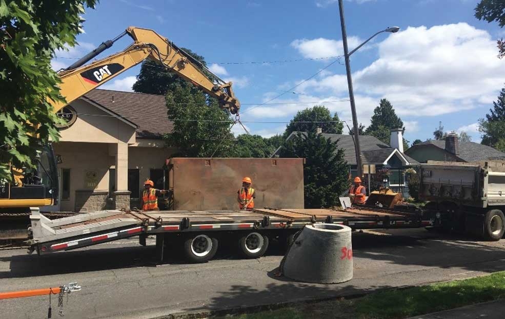
City of Vancouver Sewer OPS – N. 39th St Pipeline Replacement (2019)
With ongoing improvements to CAD (Model Space, Paper Space) it became easier to produce water and sewer AutoCAD map sheets. During the transition to an electronic format, the City continued mapping in both AutoCAD and on mylar/paper for quite a while. Several separate CAD mapping projects occurred over the years as staff worked to capture system details into digital format. Data scrubbing continued with each project, to reconcile the CAD documents with the original 50 scale paper records. Ongoing data scrubbing continues to this day whenever staff add a new project or system details not previously captured in any database.
With the initiation of the new GIS program in 2009, existing CAD sewer (and water maps, in a separate effort) were incorporated into our new GIS database. These GIS maps captured system attributes but the related data for easements and installation references were not always retained.
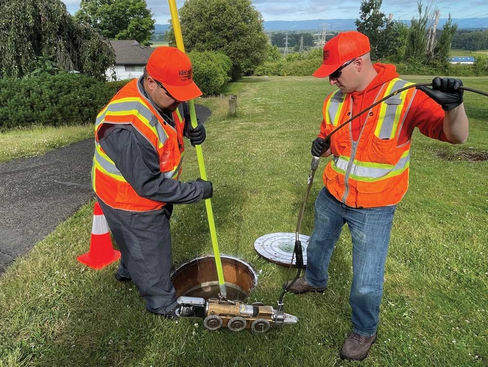
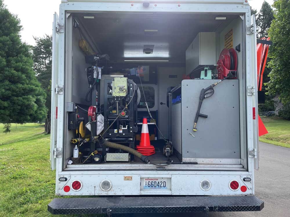
Sewer Ops (2019) and current CCTV camera technology.
As the maps were being updated and CMMS asset management system was being utilized, the CCTV program was initiated with the purchase of one van and Line View inspection software. From this we’ve successfully adopted successive versions of CCTV inspection technology to improve our defect coding and video records. We have transitioned to the Granite XP software, which is uploaded daily for GIS database updates. We’ve also used Model Builder to capture older CCTV inspections that Granite XP did not have, to construct a larger set of inspection data.
As the maps and system knowledge improved, the GIS system also has continued to grow, progressing to multiple field applications for data collection. The City originally used GeoResults Mobile in combination with Citrix servers, NetMotion and Verizon wireless to dynamically deliver Hansen (CMMS) (Now INFOR 11.35) and GIS data to field crew users. This allowed users to view dynamic/live data from the field and for users to remotely open and close work orders, and geographically track the progress of their work. GeoResults Mobile was retired in 2019 and replaced with ESRI’s web and field applications (Web App Builder, Dashboard, Collector, Survey123, Field Maps, etc.). These applications allow field users to easily interact with GIS data and edit data from a connected or disconnected mobile device. Innovyze’ Asset Planner was also added to our GIS program, to support our system analysis and develop our asset Likelihood and Consequence of Failure matrix.
Vancouver is steadily working to improve itst system inspection, field application, mapping, and data management, working together to continuously enhance the management and operations of the collection system infrastructure.
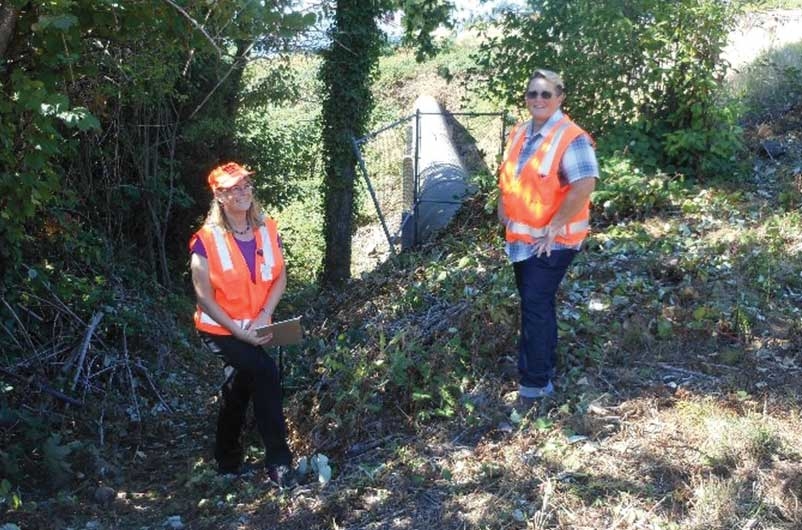
Sewer Engineering Staff survey of aerial section for “E” Interceptor April 2017.
Asset Management – One Step at a Time
Vancouver staff use asset management principles to plan and prioritize its CIP and rehab and repair work, and to develop projects that optimize the service levels and program investment. The City has successfully worked more than 35 years to build asset inventory and condition records, and system inspection and GIS programs. GIS staff use Model Builder and system data to generate criticality and condition scores that identify the most critical pipes. This supports data-driven decision-making to identify risk-based system repairs, capital improvement projects, maintain sustainable service levels, and sustain overall system integrity. Finally, the sewer engineering and operations staff continue working together to continue improving data standards and management for all parts of our project workflow, from inception, through budgeting/planning, design, construction, and project closeout.